If you plan to hike the Maximiliansweg (a part of the European long distance path E4) you’ll soon realize that there is not much information around. When it comes to backpacking virtually none. At least I had this impression the night before I took the train to Bregenz on May 5th to start stage 1 of 4. Due to a lack of time and winter coming in I got stuck at km 225 on October 6th.
However this general “guide” and the section notes at the end may give you some small hints if you’re about to do the same trail or a similar one in the high-populated D-A-CH subalpine alps. The photos taken are placed here.
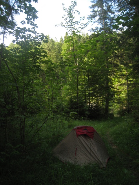
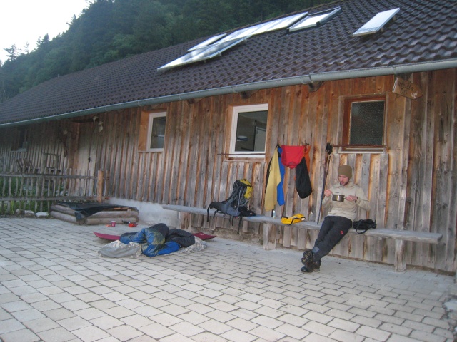
There is no need for a tent or bivvy bag here
Unfortunately this is true. Compared to North America, Scandinavia or the Pyrenees the D-A-CH region is urban: managed alpine huts, B&B and access to paved roads within 2 hours, tops. Due to that (there is also a legal issue; see below) all people I have met on the Maximiliansweg were hiking from refuge to refuge carrying a day pack and some extra stuff (slippers, indoor sleeping bag etc.). 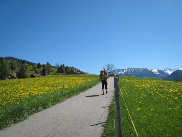
Nevertheless, there are some reasons which make it worth carrying the extra load. In my book the most important one is freedom. No need for a tight schedule, reservation calls, fixed mealtimes or earplugs. Take a longer break whenever you or the weather wants it and stop walking at dusk. The journey is the reward. Another reason is that you are able to avoid the peak season (July/August/early September) by starting in May as I did (due to this year’s snow situation most refuges stayed closed until June). 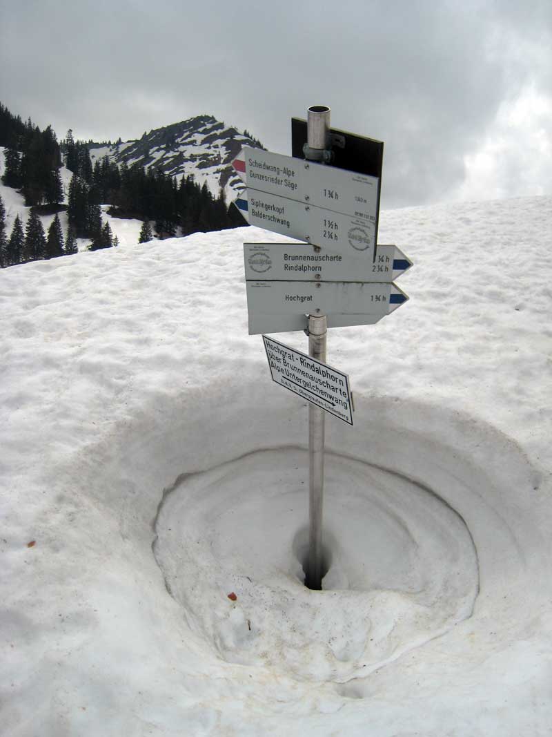 Off-season advantages are clear: less human traffic, more wildlife and a much lower chance to run into stressed out locals. For some the incentive could just be money: alpine hut prices start at around 20/30€ (breakfast/diner+breakfast), shared room of course.
The legal issue: am I allowed to camp on the Maximiliansweg?
German side
Tents are only allowed above the tree line or if you have a permission of the the landowner. From a technical point of view the trail never crosses the tree line. Only way to stay legal: ask the landowner. For obvious reasons this it not practicable. Without a tent you’re better off: a “emergency bivouac” (bad weather, darkness! and injuries) is always allowed, planned bivouacs are usually tolerated.
Austrian side
Much tougher law. Tents only above the tree line, emergency bivouacs in the “alpine area”, no planned bivouacs (this only applies to the state of Voralberg where the trail starts! Other state laws, e.g. Tyrol, are much worse).
The detailed guidelines (in German) published by the mountain associations can be found here:
- Germany – DAV: “Zelten und Biwakieren in den Bergen”
- Austria – OEAV: “Schlafen im Freien – Zelten in Österreichs Bergen mit rechtlichen Hindernissen”
- fyi -> Switzerland SAC: “Campieren und biwakieren in den Schweizer Bergen – mit Rücksicht auf die Natur”
After reading all this (don’t skip the section about the fines in Austria:-) chances are that you’ll go for the refuges. If you still stick to your tent it might be worth to read on.
rules of conduct/hints
the first one should be taken for granted. All others are field-tested: no fines or troubles with forest officials so far.
- leave no trace: even the most rigorous pack in-pack out policy (guess what this includes) is not a big deal – plenty of doggy bag dispenser/tubs around:-).
- avoid competition: stay away from anyone who offers accommodation. In Norway with its everyman’s right most hosts running the DNT huts will allow you to use their premises. Here this seems to be different: at the Walchensee I was sent away from a holiday farm despite the plan to have diner and breakfast their.
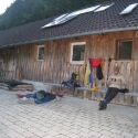 off-season: there is simply no one to compete with. Go for the bivvy and closed refuges as camp sites. Most of the huts have a useful canopy, some of them water taps, none a pit toilet.
 - make the big mistake: settle down late. During the peak season in spring/summer after 8 p.m virtually all people on the non-paved parts of the trail are gone. Only some cars coming down from the alp/lodges -> leave the yellow TNF expedition tent at home and try to replace/cover reflective parts (in my case the cords). Avoid “perfect” spots (the Eschenlainetal will test you on that!) and go for densely wooded areas. Pretend to be a day hiker: use a separate site for cooking, cleaning etc. and put no longer required stuff in the bag asap.
- talk to locals: don’t get me wrong. Most people I’ve met were very friendly, helpful and curios about the XL-backpack. They directed me to the best camp locations, offered me a ride (I’ve been able to resist so far:-) , some food or a beer. Don’t miss that part by playing hide and seek for 20 days.
Orientation: where goes the trail?
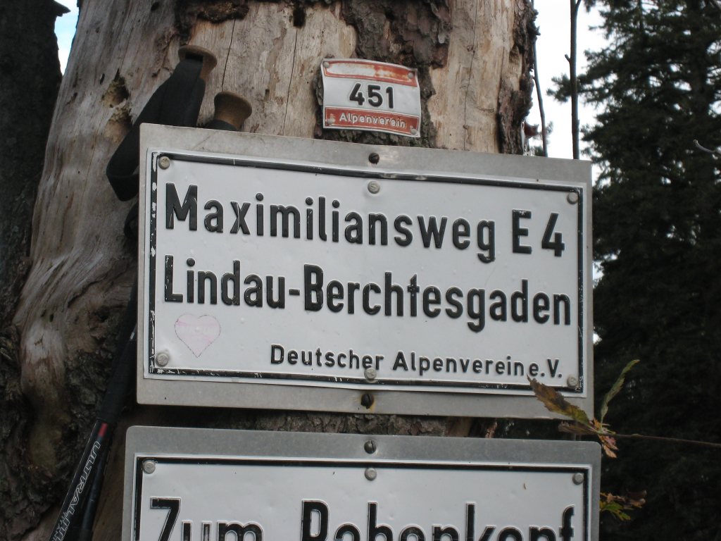
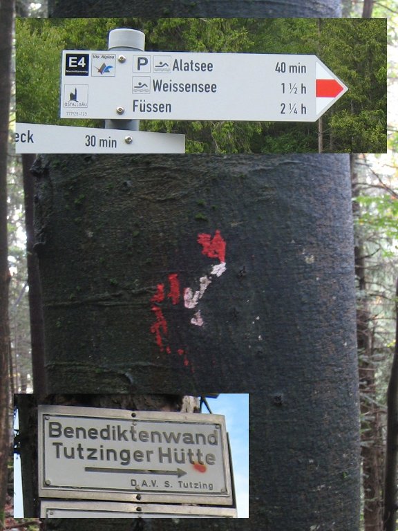
Reams of regional hiking trails form the E4/Maximiliansweg. Most of the hiking marker on those routes have a small note that you’re on the E4/Maximiliansweg. You’ll also see red colored signs/dots on trees, panels and buildings. Driving like on the autobahn. Although you can manage it without one I highly recommend you to go for a map (collection:-) for most parts of the trail. Planning/security is up to you – but some markers have only the local information on it and the red color is sometimes missing too.
map provider/quide book
- You don’t have much of a choice: Kompass Karten (1:50’000)
- Pro: the E4 is explicit marked
- Con: fair weather maps. The material/lamination is not durable enough -> the maps fall apart after two days in humid conditions.
- The hikers I’ve met were all using the only up to date guide book available. Some told me that the section maps inside were not that useful.
- Map IDs see section notes 1-4
- Buy in advance (online, bigger city bookstore e.g Kempten, Munich). Availability on the trail (smaller cities -> train station) is sometimes limited.
Equipment: what you can leave at home?
As mentioned before you’re not out in the backcountry somewhere in Alaska or B.C. Therefore it is possible to go light. I’ve been able to put all the stuff (including food) needed for four days into a 50 liter bag. Although the gear list is up to and your comfort level some hints:

- water filter: not needed -> drinking water sources are always within reach
- GPS: not needed -> overkill (see section above)
- sandals: not needed -> they do have bridges:-)
- stove: if you own a multi fuel stove go for it -> I haven’t seen a single gas cartridge (small version:-) in one of the shops/gas stations on the trail
Section notes
part 1 + 2
[table id=1 /]
part 3 + 4
[table id=2 /]